The OpenGeo Suite brings together the OpenGeo Architecture into a single, easy-to-install integrated software package. By developing each individual component of the OpenGeo Suite individually, we ensure that the Suite integrates with existing systems—proprietary or open source. It is the fastest way to get your geospatial information on the web, leveraging the power of best-of-breed open source geospatial software.
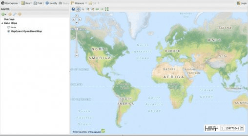
The OpenGeo Suite is a complete web mapping platform built on powerful, cutting-edge, open source geospatial components
Main features:
- Powerful Javascript components for rich mapping applications, with documentation, examples, and sample apps.
- Support for a wide variety of clients through a number of OGC services (WMS, WFS, WCS), tiles (Google, Bing, WMTS, TMS, WMS-C), and formats (KML, PDF, SVG, GML, GeoJSON, CSV).
- Complete web-based configuration and administration consoles, including enhanced import/publish workflows, with data importers, browser-based styling of maps and embeddable mapping widgets.
- Fast, native connectors to Shapefiles, PostGIS, Oracle Spatial, ArcSDE, SQL Server with publish and editing capabilities.
- Efficient raster publishing of GeoTIFF, ArcGrid, GTOPO30, DTED, ERDASImg, MrSID, JP2000, ECW (requires additional license), and mosaics and pyramids of the formats.
- Great Google Earth, Google Maps and Bing Maps support, including height, time, and ‘Super-Overlays’.
- Tools for managing server load such as Suite Analytics.
- Dashboard access to all features of the Suite through one convenient interface.
- Publish data to the web from ArcGIS Desktop with GeoCat Bridge.

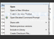
Adds an Open Command Prompt menu item to the context menus in Windows Explorer.

Windows extension that helps users to pass arguments to executable files


Comments